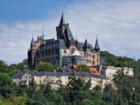
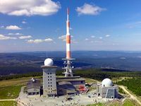
The Harz is the largest low mountain range in the northern part of Germany. The highest elevations include the Brocken at 1,141 m and the Wurmberg at 971 m. Large parts of the High Harz are protected as Harz National Park.
Essential facts
- Currency
- Euro (EUR)
- Spoken Languages
- German
- Area
- 2,226 km²
Show all factsHide fact details
Administration
- Country
- Deutschland
- Administrative Region
- Landkreis Goslar
Geography & Practical Information
- Elevation
- 1,141 m
- Calling code
- 49
Location
Climate through the year
Monthly averages for 2016–2025
Sources: Open-Meteo using Copernicus Climate Change Service ERA5
Destination guide
Orientation
The Harz is divided into Lower, High, and Upper Harz. The Lower Harz is more characterized by beech forests and agriculture, while the Upper and High Harz are dominated by deep...
Orientation
The Harz is divided into Lower, High, and Upper Harz. The Lower Harz is more characterized by beech forests and agriculture, while the Upper and High Harz are dominated by deep...
The Harz is divided into Lower, High, and Upper Harz. The Lower Harz is more characterized by beech forests and agriculture, while the Upper and High Harz are dominated by deep valleys and coniferous forests. The climate is cool and receives abundant precipitation, especially at higher altitudes.
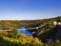
The landscape is very diverse: spruce and beech forests, high moors, mountain meadows, and near-natural flowing waters characterize the scenery. Rivers like the Bode and Oker, as well as several reservoirs, structure the region. The Brocken is the highest peak in Northern Germany and a central landmark.
Geologically, the Harz is rich in granite, slate, and limestone. This diversity forms the basis for the region's mining history and also explains the broad range of rocky terrain and hiking landscapes.
- Für Wanderungen die Höhenzonen und die damit verbundenen Wetterwechsel beachten.
- Bei Naturbeobachtungen auch Flussläufe, Talsperren und Moore einplanen.
- Historische Bergbauorte als Teil des Landschaftsbilds mitdenken.
- Nicht von gleichförmiger Mittelgebirgslandschaft ausgehen; der Harz ist landschaftlich stark gegliedert.
- Höhere Lagen nicht unterschätzen: Kühlere Temperaturen und mehr Niederschlag sind typisch.
- Klima
- Kühl und niederschlagsreich, besonders in höheren Lagen
- Gliederung
- Unterharz, Hochharz, Oberharz
- Prägende Landschaftselemente
- Wälder, Hochmoore, Bergwiesen, Fließgewässer, Talsperren
Arrival
By plane, Hannover and Leipzig/Halle are the nearest major airports; Frankfurt is significantly further away. For many journeys, train or car travel are therefore the more pract...
Arrival
By plane, Hannover and Leipzig/Halle are the nearest major airports; Frankfurt is significantly further away. For many journeys, train or car travel are therefore the more pract...
By plane, Hannover and Leipzig/Halle are the nearest major airports; Frankfurt is significantly further away. For many journeys, train or car travel are therefore the more practical options. Long-distance trains bypass the Harz region extensively.
Connections are available at stations such as Braunschweig, Hildesheim, Göttingen, Magdeburg, Halle, or Erfurt. From there, you can usually continue into the Harz itself by regional trains, often without additional changes.
Important access routes exist on the northern edge, the southwestern Harz edge, and via several east-west connections. By car, the Harz is framed by the motorways A7 in the west, A38 in the south, and A36 in the north. Several well-developed federal highways connect the surrounding towns and cross the mountain range.
For cycle tourists, the EuroVelo 13 / Green Belt, the EuroVelo 2 / R1, and the Weser-Harz-Heide Cycle Route pass through the region.
- Für Bahnreisen Anschlussbahnhöfe und Regionalverkehr im Blick behalten.
- Bei Autofahrten die Randlagen und die Höhenunterschiede der Straßen berücksichtigen.
- Für Radreisen die Korridore Grünes Band, R1 und Weser-Harz-Heide-Radweg als Hauptachsen nutzen.
- Nicht mit dichtem Fernverkehr direkt in den Harz rechnen; der letzte Abschnitt erfolgt meist regional.
- Fahrzeiten über Bergstrecken nicht mit Flachlandstrecken vergleichen.
- Bahn-Anschlüsse
- Braunschweig, Hildesheim, Göttingen, Magdeburg, Halle, Erfurt
- Nächste Flughäfen
- Hannover, Leipzig/Halle
- Wichtige Autobahnen
- A7, A38, A36
Mobility
Local bus services in the Lower Harz are operated by Harzer Verkehrsbetriebe, and in the Upper Harz by HarzBus and KVG. Public transport is therefore an important supplement for...
Mobility
Local bus services in the Lower Harz are operated by Harzer Verkehrsbetriebe, and in the Upper Harz by HarzBus and KVG. Public transport is therefore an important supplement for...
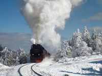
Local bus services in the Lower Harz are operated by Harzer Verkehrsbetriebe, and in the Upper Harz by HarzBus and KVG. Public transport is therefore an important supplement for excursions between places and to higher-lying destinations. The Harzer Schmalspurbahnen are particularly characteristic.
The Harzquerbahn connects Wernigerode with Nordhausen, the Brockenbahn runs from the Drei Annen Hohne junction to the Brocken, and the Selketalbahn serves the Lower Harz between Nordhausen and Quedlinburg. Museum trips are also possible on the Rübelandbahn.
Overnight guests can travel on the regional bus network with the Harzer-Urlaubsticket; it is valid together with the guest card and registration form and is financed through the tourist tax. However, regional rail connections, including the Harzer Schmalspurbahnen, cannot be used with it.
- Für Fahrten zu Ausgangspunkten von Wanderungen Bus- und Schmalspurbahnangebote prüfen.
- Beim Ticketkauf zwischen Busnetz und Bahnverkehr unterscheiden.
- Für Brockenbesuche die Brockenbahn als typische Anreisemöglichkeit berücksichtigen.
- Nicht davon ausgehen, dass das Harzer-Urlaubsticket auch für die Schmalspurbahnen gilt.
- Nicht alle Ziele mit dem Auto anfahren müssen; viele Orte sind mit Bahn oder Bus erreichbar.
- Ticket-Hinweis
- Harzer-Urlaubsticket gilt im regionalen Busnetz, nicht im Bahnverkehr
- Regionale Busanbieter
- Harzer Verkehrsbetriebe, HarzBus, KVG
- Charakteristische Bahnen
- Harzquerbahn, Brockenbahn, Selketalbahn, Rübelandbahn
Places of interest
Places of interest
- Für Aussichtstouren windoffene Gipfel und klare Sichttage bevorzugen.
- Bei Bergbaugeschichte Rammelsberg, Kaiserpfalz und Museen rund um Clausthal-Zellerfeld einbeziehen.
- Talsperren eher als Landschafts- und Aussichtspunkte als als Badeorte planen.
- An der Rappbodetalsperre keinen Wassersport oder Badebesuch einplanen; beides ist nicht gestattet.
- Nicht alle markanten Felsen im Nationalpark als besteigbar voraussetzen; einige liegen in sensiblen Kernzonen.
- Brocken
- Höchster Berg Norddeutschlands, 1.141 m
- Okertalsperre
- Mit Personenschifffahrt im Harz
- Rappbodetalsperre
- Größte Talsperre des Harzes, Trinkwassertalsperre
Things to do
Hiking is the most important activity in the Harz.
Things to do
Hiking is the most important activity in the Harz.
- Für Mehrtagestouren den Hexenstieg oder den Grenzweg als Hauptachsen prüfen.
- Bei Sammlertouren die Stempelstellen der Harzer Wandernadel einplanen.
- Für Familien und leichte Radfahrten den Südharz-Eisenbahn-Radweg berücksichtigen.
- Bei Sturm nicht wandern; im Oberharz können Böen Bäume auf Wege werfen.
- Den Naturistenstieg nur nutzen, wenn das besondere Konzept bewusst gewählt wird.
- Harzer Hexenstieg
- Weitwanderweg von Osterode nach Thale
- Harzer Wandernadel
- 222 Stempelstationen im Gebirge
- Harzer Naturistenstieg
- Einer von zwei Nacktwanderwegen in Deutschland
Dining and Drinking
Typical regional dishes include Hackus and Knieste, as well as Runx-Munx. Both represent down-to-earth, hearty Harz cuisine with potatoes, meat, and vegetables or cabbage.
Dining and Drinking
Typical regional dishes include Hackus and Knieste, as well as Runx-Munx. Both represent down-to-earth, hearty Harz cuisine with potatoes, meat, and vegetables or cabbage.
- Regionale Spezialitäten wie Harzer Roller und Harzer Küche als Teil des Reiseerlebnisses einplanen.
- Für Brau- oder Verkostungsthemen Altenau besonders berücksichtigen.
- Auf lokale Bezeichnungen achten: Manche Speisen wirken einfacher, sind aber sehr regional verankert.
- Den Namen der Stolberger Lerchen nicht wörtlich verstehen; es handelt sich nicht um Vögel.
- Harzer Roller nicht nur als jungen, milden Käse erwarten; der Geschmack wird mit der Reife kräftiger.
- Biertradition
- Altenauer Brauerei, Brauerei seit 1617
- Typische Gerichte
- Hackus und Knieste, Runx-Munx
- Bekannte Spezialitäten
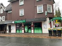
- Harzer Roller, Schierker Feuerstein
Practical information
The Harz's landscape is strongly shaped by its mountainous location. In the Oberharz, climatic conditions are harsher than in the lowlands; especially at higher altitudes, storm...
Practical information
The Harz's landscape is strongly shaped by its mountainous location. In the Oberharz, climatic conditions are harsher than in the lowlands; especially at higher altitudes, storm...
The Harz's landscape is strongly shaped by its mountainous location. In the Oberharz, climatic conditions are harsher than in the lowlands; especially at higher altitudes, storms and drought can cause problems. Therefore, for hiking, weather conditions, trail conditions, and wildfire risk are important factors.
Emergency points marked by the forestry department at forest entrances serve as an orientation aid in emergencies. They can help with emergency calls and should be noted on longer tours.
The place names also deserve some attention: Some mountain towns like Altenau, Clausthal, Lautenthal, Sankt Andreasberg, Wildemann, and Zellerfeld historically bear the title of town, even if they seem small today. Being called a village can be perceived as inappropriate there.
- Wetter, Wind und Trockenheit vor jeder Tour prüfen.
- Notfallpunkte bei längeren Wanderungen bewusst wahrnehmen.
- Ortsbezeichnungen im historischen Kontext verwenden.
- Bei Sturm nicht in den Wald gehen oder auf Höhenwegen bleiben.
- Die kleineren Bergstädte nicht vorschnell als Dörfer bezeichnen.
- Wetter
- Im Oberharz rauer als im Flachland
- Waldrisiko
- Sturm und sommerliche Trockenheit können problematisch sein
- Orientierungshilfe
- Notfallpunkte an Waldeingängen
Security and Safety
In the Oberharz, strong gusts pose a significant hiking hazard, as trees can fall onto paths. Avoid hiking during storms. In summer, drought adds another danger, as forest fires...
Security and Safety
In the Oberharz, strong gusts pose a significant hiking hazard, as trees can fall onto paths. Avoid hiking during storms. In summer, drought adds another danger, as forest fires...
In the Oberharz, strong gusts pose a significant hiking hazard, as trees can fall onto paths. Avoid hiking during storms. In summer, drought adds another danger, as forest fires are possible. If you are in the forest, know the emergency points.
They serve as location references for the emergency dispatch center in case of an emergency. Good planning is advisable, especially in remote or wooded areas.
- Bei Sturm oder starkem Wind Wanderungen verschieben.
- Notfallpunkte und Zugangspunkte vorab merken.
- Im Sommer besonders auf Trockenheit und Brandrisiken achten.
- Keine Wald- oder Höhenwanderung bei Sturm unternehmen.
- Trockenes Unterholz und Waldbrandwarnungen nicht ignorieren.
- Hauptgefahren
- Sturm, umstürzende Bäume, sommerliche Trockenheit, Waldbrandgefahr
- Rettungshilfe
- Notfallpunkte als Ortsangabe
Excursions and Connecting Destinations
Destinations for day trips in the north include Braunschweig, Wolfenbüttel, and Salzgitter. In the east are Magdeburg and Halle (Saale), in the south the Kyffhäuser Monument nea...
Excursions and Connecting Destinations
Destinations for day trips in the north include Braunschweig, Wolfenbüttel, and Salzgitter. In the east are Magdeburg and Halle (Saale), in the south the Kyffhäuser Monument nea...
Destinations for day trips in the north include Braunschweig, Wolfenbüttel, and Salzgitter. In the east are Magdeburg and Halle (Saale), in the south the Kyffhäuser Monument near Bad Frankenhausen, the Eichsfeld with Duderstadt and Erfurt, and in the west Hildesheim, Einbeck, Northeim, and Göttingen.
This can be helpful for a trip to the Harz if you want to combine your arrival or departure with a stop. The outlying areas of the mountains are particularly easy to combine with these cities.
- Randstädte als Ergänzung zu Natur- und Bergbauzielen prüfen.
- Bei längeren Reisen An- und Abreise mit einem Stadtstopp kombinieren.
- Nicht alle Ziele in einer einzigen kurzen Fahrt erwarten; die Region ist groß und gegliedert.
- Osten
- Magdeburg, Halle (Saale)
- Norden
- Braunschweig, Wolfenbüttel, Salzgitter
- Süden
- Kyffhäuserdenkmal, Eichsfeld, Erfurt
- Westen
- Hildesheim, Einbeck, Northeim, Göttingen
More about Harz
Loading Wikipedia chapters…